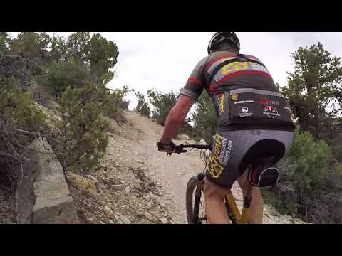
View from the bottom on the high-expert DH on the west-side trails. Photos and initial review by Bruce on July 29, 2021. Updated May 23, 2023.
Lower Applecross Trails
The lower Applecross trails, new in 2021, lie on both sides of the North Fork Road just 0.2
miles uphill from its origin on Highway 9 east of Zion National Park. Trails range from very
easy to very difficult. At 6000 feet elevation, the expected riding season will be mid May
through October. These lower Applecross trails are part of a larger system with around 35 miles
of singletrack trail (with some of it still under construction in 2023). The other trails in this system include
Applecross
at Clear Creek
and
Upper
Applecross.
West of the North Fork road are three DH trails (Lunar Escape, Lunar Run, Bison Chute) served
by a climbing trail called Little Dipper. Little Dipper also continues on north to the head
of Waterpocket Canyon, linking to the uphill end of a one-way expert traversing trail, Bison
Escape. This is also your route to connect to the newer trail systems in
Clear Creek Canyon
reached via the Canyon Connector trail, and on to the
upper Applecross trails
further up the hill.

At the top of the hill on Bison Chute.

Crossing the wash on the connector to Pinion Run.
Across the North Fork Road is a second small trail complex consisting of the loop trail Pinion
Run and two expert-level descending trails Radio Flyer and Juniper Rush that lie within that
loop. A singletrack connector takes you from the trailhead staging area across the road and
over to Pinion Run.This review will discuss the individual trails in sections for east side, west side, and northwest
corner.

Trailhead, looking north.
The trailhead is located on North Fork Road, just one mile outside the eastern border of Zion
National Park off Highway 9. From inside Zion, drive uphill and out of the eastern gate, then
turn left onto the North Fork (Zion Ponderosa) road.From US-89, turn westbound at the Carmel Junction onto Highway 9. Drive 11 miles then turn
right on the North Fork road.About 0.2 miles after turning onto the North Fork road, there's a fenced parking strip on your
left.
The trailhead area features a "corral" that all bike traffic passes through. Pedal into the
fenced area and turn left to begin climbing on Little Dipper. If you're headed to Pinion Run,
turn right as you enter the fence, then right again to find the singletrack connector trail
eastbound along the fence.Traffic from the downhill trails will come into the northern side of the fenced staging area.

Drone view of the staging area, as Bruce turns to take another lap.

Northbound early in the climb up the main loop.
Pinion Run (Main East Loop)
The connector trail to Pinion Run starts inside the fenced staging area, to your right as you
enter the "corral." Cross over the North Fork road and find continuing singletrack with a bridge
over the wash. The trail will veer around 180 degrees as it crosses a meadow to the flank of
a small hill, then head southbound along the edge of the hill to the loop.
The trail straight ahead is the return part of Pinion Run's one-way loop. At the loop fork,
keep left. Pinion Run will turn 180 degrees uphill on a slow left curve. Climb uphill steadily
for 1/2 mile to reach the traversing section at the top where the alternate trails lie. You'll
gain only 100 feet of elevation, so the climb is suitable for beginners.

Rolling along a limestone ledge as we pass manzanita and yucca.

The main loop is suitable for beginners.
All these trails lie within a layer of white clay and limestone. There's an occasional splash
of orange dirt. The trails are machine-cut with undulations to shed water. At the time of my
ride in 2021, trail signs were just being placed. Trails are now well-marked at every intersection.The Pinion Run loop is 1.7 miles around, with around 150 vertical feet of total climbing.
The first trail option off Pinion Run comes at mile 0.6 of the ride. A sign indicates a short
expert alternate line uphill on the left.There are two of these expert alternate lines. (The second comes at mile 0.8 of the loop.)
They're very short and not at all hard to pedal. But they both end with a rock-drop as you
bounce back down to the main trail.

"More technical option" marker. When you see this, it's just a short alternate line with a tricky spot.

Aaaand here it is. A stair-step down to the main trail.
About 30 feet past the entry to the first tech alternate line (uphill to your left), there's
a sign for Juniper Rush (one-way downhill flow trail, see below). Juniper Rush forks off on
your right and quickly hooks around to reverse direction. Keep straight if you're staying on
the main loop.
At mile 0.9 Radio Flyer (see below) forks uphill to your left, then crosses the trail about
100 feet later. Keep straight and level to stay on the main loop.The Pinion Run loop trail will descend a little, then turn back to the west. You'll be joined
by Radio Flyer. There's some fun twisty stuff coming up.

Some wiggles and fun bumps on the bottom side of the main loop.

When you hit the red dirt, you're almost finished with the main loop.
As it approaches the trailhead area, Pinion Run heads a bit uphill and turns back to the north.
It's joined by Juniper Rush just a few feet before it hits that first turn where you started
uphill on the main loop. Keep to the right and uphill to make another round, or go straight
and left to head out on the connector trail.

On the left uphill is a tech alternate line. Ahead at the second marker (middle of photo), Juniper Rush hooks around as it forks away to the right.
Juniper Rush
Juniper Rush is an intermediate DH-only (signed as expert) trail that forks away from the main
loop at mile 0.6 of the ride. At the entry it hooks around to the right and descends around
80 vertical feet over 0.3 miles.
After rolling through dips and banked turns, Juniper Rush rejoins Pinion Run (the main loop)
just a few feet before the trail fork for the main loop.

Looking down at Highway 9 from Juniper Rush.

Here's the entry to Radio Flyer, on the left. Although it's a downhill-only trail, it starts with this little uphill jaunt into the trees.
Radio Flyer
Radio Flyer forks away to the left uphill at mile 0.9 of Pinion Run. Radio Flyer would be considered
a skilled upper-intermediate level ride and is signed as expert. It is one-way.
After pedaling up into the trees to the left of the main loop, you'll turn back downhill and
cross over the main trail. (There's a mashed Radio Flyer on the side of the trail just before
the cross-over.) Watch for oncoming riders from your right.

About to cross the main loop as we see the Radio Flyer. Look for riders!

Here's the rock drop. The main trail goes right across the platform at the top of that rock drop.
The cross-over spot has a rock drop of around two feet. If you don't think you can do that,
take the stair-steps (see photo).
The descent features a table jump, a double, a step-up, and lots of bermed turns. There's a
log ride that gets steadily narrower. Fun stuff, but over too quickly.

Looking down Radio Flyer.

A rock ramp onto a log ride, just for fun.
Radio Flyer is only 0.2 miles long with a drop of 50 vertical feet. It joins the bottom side
of Pinion Run for a west-bound return.

Entry to the climbing route. We're in a little "corral" off the main parking strip.
Little Dipper (Climbing Trail)The climbing route to all the west-side trails -- and to the
Clear
Creek
trails -- is called Little Dipper. It
heads southbound from the trailhead. It will be to
your left as you enter the little "corral" from the parking lot. It's a machine-cut trail that's easy to ride.
At mile 0.4 from the trailhead, there's a trail fork. This one is critical if you're headed
for the DH trails. If your goal is Lunar Escape, Lunar Ride, or Bison Chute, make a 180-degree
right turn uphill at this spot. (Little Dipper itself continues straight uphill from here to
the top of Waterpocket Creek.) The trail to your right, signed as Lunar Ride, will climb 0.1
mile to the top of all the DH routes.If you're headed for Bison Escape (the expert-level trail back to the top of the DH trails,
see below) stay straight and continue the climb uphill on Little Dipper.

Typical view on the climbing route to the DH trails before it hooks to the right uphill (while Little Dipper trail continues straight up the little valley of Waterpocket Creek).

Fork where Lunar Run turns uphill to the DH trails.
The Little Dipper trail continues north at the fork at mile 0.4 where the climbing trail turns
sharply uphill to the right, following the canyon above Waterpocket Creek. At mile 1.1 from
the trailhead, you'll reach a trail fork. The northbound (left-hand) trail is Canyon Connector,
linking to the trails in Clear Creek (see below). Southbound to your right is Bison Escape
(see below). There's also a connector out to the road for patrons of Clear Creek Ranch, straight
ahead as Little Dipper hits the 4-way trail fork.
Lunar Ride (Intermediate DH trail)
The Lunar Ride downhill route forks to the right from the climbing trail (which is also officially
part of Lunar Ride) at mile 0.5 from the trailhead. It descends 100 vertical feet over 0.2
miles. It's machine-cut with dips and banked turns. There are a lot of little "whooshes." Nothing
scary.

Here's the trail fork for the intermediate DH trail, on the right.

Handlebar view of a banked turn. Even after two years (2023 photo), it's still chunky and loose. Smooth flow is what works best here.
The dirt is mixed with little limestone slabs. These tend to skitter around a bit under your
tires. So the best strategy is: go fast and let the bike roll the line around the corners.
Brake-clutching and timid riding is your enemy on this trail surface.Lunar Ride ends at the uphill entry to the "corral" bike-staging fenced area.
Lunar Escape (Beginner DH trail)
At the top of the climbing trail at mile 0.5 from the trailhead, keep left as Lunar Ride forks
away to the right. Pedal another 30 feet then keep right onto Lunar Escape as expert Bison
Chute goes left and uphill.

Climbing past Lunar Run to Lunar Escape. Lunar Escape is about 20 feet up the trail from the marker post.

A look down the trail.
Lunar Escape starts as a flat trail. For the most part, it's an easy descent as it winds back
and forth on the hillside. But there are some tight corners with steep banks on the lower portion
that will spook beginners. But you've got to roll them. If you brake and go slow, you'll slide
sideways in the loose chunder.Lunar Escape will tie into the bottom of Bison Chute for the final 100 feet before the trailhead.
Bison Chute (Double-black DH Trail)
To reach the high-expert Bison Chute descending trail, turn right uphill at mile 0.4 of the
climbing trail, then keep left where the intermediate DH trail (Lunar Ride) and the beginner
DH trail (Lunar Escape) start at mile 0.5 from the trailhead. The trail rapidly becomes a narrow
more-technical hand-carved trail.Continue up onto a mesa. Your total climb will be 150 vertical feet. Follow the singletrack
around to the east and drop downhill. The fun is about to start!

On the mesa edge. The expert traversing trail is just 15 feet to our left, below the little cliff. Nice spot to take in the views.

First stunt, diving board onto a rock ramp.

Next, a skinny log ride.

Steep slab-rock fall into a turn to the right.

A taller slab-rock fall into a turn to the left.

Final high-speed turns before hitting the receiving corral. Great stuff!
The trail drops 150 vertical feet over 0.3 miles. There will be various stunts, most of which
have NO ride-around. This includes a skinny tree slab that drops onto a rock ramp, a two-foot
full-air rock drop, and a couple of almost free-fall rock ramps that have major G forces in
the turns at the bottom. So don't hit this trail unless you're ready to commit. It truly requires
double-black skills.The trail ends at the little corral by the parking strip.

View down the trail, heading south. Up and over the rock slab.
Bison Escape (one-way traversing technical trail)
There's an expert-level trail just below the mesa edge. It's one-way north to south. It starts
at the uphill end of Little Dipper, just after completing a difficult S climbing turn before
the 4-way trail intersection. Bison Escape is to your right, over a rock outcrop, so the entry
is not easily noticed.
The Bison Escape trail is narrow and technical. It's 0.7 miles long, with no overall elevation
change. It bounces over lots of rocks and ledges as it hugs a shelf just under a band of limestone
cliff.On the southern end, it joins the Lunar Run climbing trail just before the fork where the intermediate
Lunar Run DH route starts. So you can access any of the three DH trails from the south end
of Bison Escape.

Skirting the edge of the limestone -- lots of rock challenges and ledges.

Getting near the top of the trail; almost to the road.
Canyon Connector
To reach Canyon Connector, take Little Dipper and continue north. At mile 1.1 from the trailhead,
turn right at the 4-way intersection (where the Clear Creek Ranch connector and Bison Escape
fork away). Canyon Connector will descend and cross the creek near a culvert that goes under
the road, then turn and climb.Depending on floods and trail maintenance, the trip through the dip can be an ugly boulder
scramble. Immediately after you get out of the dip and onto the western side of Waterpocket
Canyon -- mile 1.3 from the trailhead -- the Ridge Runner loop forks away on your left. (In
2023, the Ridge Runner trail is barely developed. Both the entry and the trail itself are hard
to see.)
Canyon Connector will meander west for 1.1 miles, then turn left along the edge of Clear Creek
Canyon. If you continue, the trail will descend down to Clear Creek, where you'll encounter
an extensive trail system. (These
trails in Clear Creek Canyon
and in the
upper system above North Fork Road
are not officially open yet. But I was told you can ride if you mind your manners and stay
away from work crews.)

Following the Canyon Connector trail toward Clear Creek Canyon.

This is the entry to the trail. You wouldn't see it if not for the rockpiles.
Ridge Runner
I'm mentioning Ridge Runner here only because in 2023 it's shown on the map at the trailhead.
But the trail is more concept than reality. Branches have been cut to clear a trail corridor,
but there's no real work on the trail path and the riding isn't great. It's 0.6 miles as an
out-and-back loop off the Canyon Connector trail.
Ridge Runner is an elongated lariat loop along the western edge of Waterpocket Creek Canyon.
The trail splits into the loop about 100 yards from the fork off Canyon Connector. At mile
0.3 it will turn back at a banked turn -- which is the only spot that really looks like trail
in May 2023.

On the way back on the lower (eastern) side of the loop. Not many people riding it.