Looking north as we approach a rock outcrop from the uphill end of the main Litt...
Looking north as we approach a rock outcrop from the uphill end of the main Little Valley trail. Photos and Little Valley trail review by Bruce on August 11, 2013. Instructional trail system added December 11, 2014 and updated August 11, 2015.
Little Valley
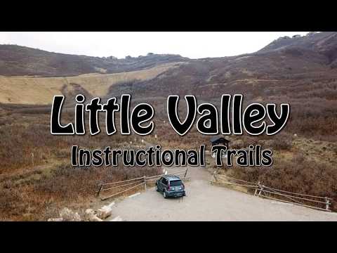
Little Valley Trail and Instructional Trail System

The Little Valley Loop Trail forks from, then rejoins Ann's Trail just across Traverse Ridge Road from Potato Hill. The area is just east of Draper's Corner Canyon . The main Little Valley trail was completed in 2013. The Little Valley Instructional Trails and trailhead were added in December 2014 and expanded in 2015.

The main Little Valley trail is only 0.7 miles in length, joining to Ann's Trail at both ends. Because it starts a short distance from the Potato Hill Trailhead on Traverse Ridge Road, it's possible to ride the trail as a short lariat loop of only 1.4 miles. Or ride a simple loop from the Little Valley trailhead. Just go to the uphill trail kiosk (where you enter the downhill trails) and you'll find the Little Valley trail there.
The new Little Valley trailhead. The exit off Traverse Ridge Road to the trailhe...
The new Little Valley trailhead. The exit off Traverse Ridge Road to the trailhead is still seeing some construction activity (August 2015). If there's a barrier across the gravel road, drive a bit further uphill to the Potato Hill trailhead and take Ann's Trail under the road and down to Little Valley.
This is the main access (beginner) trail in the middle of the Little Valley Inst...
This is the main access (beginner) trail in the middle of the Little Valley Instructional Trails system. We're looking north. August 2015.
The Instructional Trails lie to the west of the main Little Valley Trail. All of the Little Valley trails are suitable for beginners. Grades are mild and the surface is smooth. This little trail system was built specifically for families and beginners to work on their biking skills.
Little Valley Main Trail

From its beginning on Ann's Trail about 200 feet south of the tunnel, the Little Valley Trail will descend only about 60 vertical feet, then regain 80 vertical to reach the high spot as it rejoins Ann's further southwest. There are occasional views of the valley, but most of the riding is in thick oak forest.

Typical riding view. Lots of deep gambel oak forest.
The rides Oh Wow spot. The trail climbs around this rock outcrop. Later, well be...
The ride's Oh Wow spot. The trail climbs around this rock outcrop. Later, we'll be on top of this rock.
There are three trail forks on Little Valley. Unfortunately, the first one is right at the point where Little Valley forks off Ann's. Two separate riders came by while I was taking a photo of this spot and despite the nice trail sign they were confused. When you reach the first trail fork on Ann's 200 feet from the tunnel, veer to the right (you're now on Little Valley). Keep straight. The immediate left fork takes you back up to Ann's.

The trail on the right (between the two big rocks heading west downhill) is a steeper narrow route that crosses the east side of Little Valley Loop trail before ending on the broad middle trail.

The next fork, on your right, is the connector to the loop trails. For now, keep straight and left to stay on the main Little Valley route.

The neighborhood connector trail is plainly marked and non-confusing. It's found just a bit past the half-way point of Little Valley (when riding counterclockwise east-to-west) and descends 1/10 mile to Maple Park Court. Yes, I suppose you could ride the road to the trailhead to make a loop-on-the-loop.

View to the west from the trail as we approach the connector to the homes.
Weve now climbed and reversed direction and are riding across the top of the roc...
We've now climbed and reversed direction and are riding across the top of the rock cliff we skirted below.
The highlight of the ride is the rock outcrop you'll pass, first on the underside and then over the top. Looks like some type of marble.
Most riders will do Little Valley as an alternate route while riding Ann's Trail or Potato Hill It's an interesting little trail that adds to the riding options in Draper, but few riders would consider it a destination in itself. The exception would be true beginners and young riders for whom a 1.4-mile loop is plenty.
The upper trail fork. Were looking west. Thats Anns on the left, and Little Vall...
The upper trail fork. We're looking west. That's Ann's on the left, and Little Valley to our right.
View north from the junction of Little Valley with Anns on the uphill end.
View north from the junction of Little Valley with Ann's on the uphill end.
Riding notes, mini-loop from Potato Hill:
0.0  North through opening in fence, right
0.1  Keep R (L=Potato Hill Trail) N40 29.285 W111 50.845
       50 feet, then R and through tunnel
0.2  Fork soft R then keep straight N40 29.176 W111 50.817
       (90-degree R = to streets)
0.6  Keep L (R = to streets) N40 29.072 W111 51.102
0.9  Straight onto Ann's N40 29.061 W111 50.920
       (hard R = uphill on Ann's)
1.2  Keep R past first fork - After tunnel, fork L
1.3   Keep L (R = Potato Hill Tr)
1.4   Back at trailhead
The Little Valley Instructional Trail System
Map-post kiosk at the upper end of the trails. Were standing just a few feet fro...
Map-post kiosk at the upper end of the trails. We're standing just a few feet from the main Little Valley Trail, looking north toward Potato Hill. A-Line is to our left. The trail by my bike is the foot trail to the top of the hill. B-Line and C-Line are to the right.
The Little Valley Instructional Trail system is designed to help new riders develop their skills. There's a broad Beginner Trail that ties everything together top-to-bottom, and four fun flow trails that twist and roll but are easy for a beginner to ride.

If you're already on the bike, you can reach the system just after passing under Traverse Mountain Road. When westbound from the Potato Hill area, you can enter the trail system just 0.1 miles down the Little Valley trail from Ann's Trail. There's a staging area with a map kiosk as you turn off Little Valley.

Most riders with children will want to use the new Little Valley trailhead. The Beginner Trail (the heart of the system) starts at the southeast corner of the parking area and quickly connects to other options. This trail continues up to the kiosk at the intersection with the main Little Valley Trail.
A very young rider heads into A-Line.
View northwest on the east side of A-Line. The path is wide enough for Moms to r...
View northwest on the east side of A-Line. The path is wide enough for Moms to ride alongside their little bikers.
When climbing the Beginner Trail, you'll first pass the bottom of the D-Line trail on your right, then the A-line on the right and C-line on the left opposite each other.

You can ride the system using the Beginner Trail for all the climbs, having your choice of A, B, C, and D Lines downhill. Or, you can ride loops using one of the narrower trails for your climb. Most riders head for the C-Line trail (furthest east) as a climbing route.

A mini-loop of A-Line and C-Line is 0.6 miles long. A-Line (located south of the Beginner Trail) is very easy riding. C-Line on the north has some humps, tighter turns, and a little bit of slope, but it's still within the range of a brand-new mountain biker.

The upper end of the D-Line Trail connects to the Little Valley trail itself, and is the only trail that's not directly available at the upper kiosk. To take this trail downhill, pedal to the upper map signpost at the end of the Beginner Trail. Find the Little Valley trail, which passes just south of the clearing by the kiosk, and turn right. It's about 0.2 miles to D-Line. D-Line is the narrowest and most twisty of the trails, but I'd still consider it easy.

There are occasional breaks in the oak brush groves. Were heading downhill (coun...
There are occasional breaks in the oak brush groves. We're heading downhill (counterclockwise) on C-Line.
A series of rollers on C-Line on the northern half of the mini-loop, eastbound c...
A series of rollers on C-Line on the northern half of the mini-loop, eastbound clockwise.
The easiest possible loop is to ride up the Beginner (Access) Trail, then down the A-Line Trail just to the south. This will be about 0.4 miles total, and the entire route is flat and wide with very easy pedaling.

There are two trails here that are foot-traffic only. (Signage is still pending in August 2015.) One is the short path to the top of the little hill near the upper kiosk, and the second is the skinny trail that drops steeply from the spot where Little Valley forks away from Ann's at the north end. You'll see this trail as it crosses C-Line.

There's some fun stuff built into the trails. For example, the multiple rollers let kids and newbies practice keeping their weight centered as the bike tilts. Occasionally the trail gets a bit narrower, but in most areas it's possible for the little beginner and the big instructor to ride side-by-side.
The one-way B-Line trail is narrower and a bit more challenging, but would still...
The one-way B-Line trail is narrower and a bit more challenging, but would still be considered very easy.
Bridge over a ravine around the highest point of the mini-loop of A-Line and C-L...
Bridge over a ravine around the highest point of the mini-loop of A-Line and C-Line.
B-Line is a short one-way downhill trail that starts just east of the upper kiosk. It joins the A-line a bit before the parking lot. Although narrower, it's also an easy ride. The turns have nice berms to herd the little ones along the path.
Bottom Line!

The Little Valley Instructional Trail system is going to be your best choice in the Corner Canyon area for children and beginning riders. And for advanced riders, it's worth a detour off Ann's to check it out.

In August 2015, newly planted signposts are waiting for their signs. Were lookin...
In August 2015, newly planted signposts are waiting for their signs. We're looking down the start of B-Line.

A fall ride on the instructional trails...

[Back to video list ]
Little Valley map
Little Valley map
Getting there, Little Valley trailhead:
Take the Bluffdale exit from I-15 and turn east towards the mountains on Highland Drive. At the light at the top of the hill, turn right on Traverse Ridge Road (also called Traverse Mountain Road). After one mile, pass Mike Weir Drive on your left. Continue uphill past the paved turnoff into the homes on the right, then turn right into the Little Valley trailhead. The trail begins at the southeast corner of the parking area. N40 29.203 W111 50.994
Potato Hill trailhead:

Drive up the Traverse Ridge Road as above, but go past the Little Valley turnoff. About 100 yards further uphill, turn left into the Potato Hill TH,  N40 29.300 W111 50.925
Riding resources:
Printable one-page guide to this trail
GPS track files (right-click and select "Save Target as..."):
    Little Valley only
    Little Valley from Potato Hill
    Little Valley multitrack trails
    Draper Area Trails multi-track file
    Satellite map for printing:  View
Corner Canyon area trail overview page
Lodging, camping, shops:     Links to southern SLC resources