View about half-way up Clarks Trail in 2007. Original review by Bruce in 2007, l...
View about half-way up Clarks Trail in 2007. Original review by Bruce in 2007, latest update 2017.
Clark's Trail

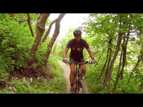
Clark's Trail can be part of a great bike ride that's close to civilization. One of the first trails completed in Draper's Corner Canyon , Clarks remains a key climbing route. Many riders use Clark's Trail as their uphill for a wide variety of excellent loop rides. The trail is 1.4 miles long and intermediate in technical requirement. Because of the sustained pitch of this trail, Clark's is a strenuous climb.

Clark's Trail has been converted into a one-way uphill-only climbing trail for bikers. (Hikers can go either direction.) Ignore any routes or ride plans that feature Clark's Trail as a downhill -- these are left-overs from years past!
The surface is firm dirt with an occasional rock and many small roots. Turns are broad and sweeping (no switchbacks). While I've rated it intermediate, experienced beginners with monster-strong legs can manage this climb. There's nothing tricky here -- just tough pedaling.

Clark's Trail will be easily damaged if ridden when muddy. Do NOT ride in wet conditions! See the Corner Canyon trail closure page for the current status.

View over the Rocky Mountain Elements handlebar as we climb mixed forest of oak ...
View over the Rocky Mountain Element's handlebar as we climb mixed forest of oak and maple. October 4, 2016.
View toward Traverse Ridge with Box Elder Peak above and Jacobs Ladder at far le...
View toward Traverse Ridge with Box Elder Peak above and Jacob's Ladder at far left, from about 1/2 mile up the hill.
Clark's Trail is 1.4 miles with 750 vertical feet of climbing, from Coyote Hollow to Ann's Trail near the Peak View Trailhead. It will be 1.6 miles to Peak View. That's an average grade of just under 10%. There are many riding options once you get to the top, but you'll need to select another trail for your descent. Popular options include the Clarks to Ghost Falls Loop , the Clarks to Canyon Hollow loop , the Rush downhill flow trail, and Ann's Trail either as the big Draper Rim loop or the smaller loop via Potato Hill .
The many ways to get to Clark's Trail...

You can quickly hop onto Clark's from the Coyote Hollow trailhead, but most riders arrive via the westbound Corner Canyon Bonneville Shoreline Trail (BST) or the eastbound Draper BST . The BST is the key to using Clark's. First, let's consider how to get there from downhill.

Downhill on the BST connection between Coyote Hollow and Clarks bridge. This sec...
Downhill on the BST connection between Coyote Hollow and Clark's bridge. This section has two-way traffic.
Looking east from the BST as Clarks heads across the bridge to begin its climb.
Looking east from the BST as Clark's heads across the bridge to begin its climb.

The Corner Canyon Trail climbs from the Equestrian Center parking to the BST at the big doubletrack-junction a mile uphill. Orson Smith climbs to Aqueduct (which connects to the Corner Canyon BST) or the north BST near Bear Canyon. You'd go westbound to get to Clark's.

In the west, Oak Hollow and Spring Hollow climb to the Draper BST , or you can access it from the Red Rock trailhead on Mike Weir Drive. Take the BST eastbound and connect to Clark's just 1/10th mile above Coyote Hollow.
Looking northwest from the trail as we begin the climb.
Bruce rounds a quartzite outcrop as Clarks temporarily breaks out of the deeper ...
Bruce rounds a quartzite outcrop as Clark's temporarily breaks out of the deeper forest to scrub oak. We're looking northwest. (Drone photo, May 2017)
Now, about getting over to Clark's from the uphill side. Again, you have to reach the Bonneville Shoreline Trail On the east, Ghost Falls , Rattler , Rush , and Canyon Hollow descend the mountain to the CC BST, from which you can go west to Clark's.

To the west, Potato Hill, Red Potato , and western Ann's Trail will descend the Draper BST , and you'd proceed east to get on Clark's.

Powering through a turn as we climb uphill.

Video showing a climb on Clark's trail...

[Back to video list ]
View of the forested riding, back when Clarks was just a newborn.
View of the forested riding, back when Clark's was just a newborn.
Details on the trail...

From the trailhead at Coyote Hollow, you quickly encounter a fork that goes to the eastbound Bonneville Shoreline , with connections to Canyon Hollow and the Silica Pit trail, then Creekview and the lower Corner Canyon trail . Go right uphill for Clarks. At the next fork, turn left across the bridge. 

Now begin climbing, first through gambel oak, then through mixed oak and maple. For over 95% of your climb, the trail is shaded riding in forest.

Once you cross the bridge above Coyote Hollow, there are NO trail forks on Clark's until you reach Ann's Trail near the trailhead on Traverse Ridge.

The trail meanders a bit, but without any sharp turns. The biggest challenges ar...
The trail meanders a bit, but without any sharp turns. The biggest challenges are steeper spots where you need to grunt a little.
Higher on the mountain, looking north. At the bottom, you can see the doubletrac...
Higher on the mountain, looking north. At the bottom, you can see the doubletrack fork between the Corner Canyon trail, Canyon Hollow DT connector, and the Corner Canyon BST. Coyote Hollow is out of the photo to the left.
There will be occasional breakout views north over the Salt Lake Valley. Straight ahead, you'll see Traverse Ridge. As you gain altitude, the mountains east of Utah Valley will begin to appear -- Box Elder, then Timpanogos.
The trail has a bit of rolling. But it's in the form of increased pitch rather than grade reversal. So don't count on coasting. Not for one second. This is a sustained climb at an average grade of around 10%. Take a break if you need to. (A trail photo is a good excuse.)
Little Rocky takes a break against a stout maple.
A rider eastbound on Anns arrives at the spot where Clarks joins Anns Trail just...
A rider eastbound on Ann's arrives at the spot where Clark's joins Ann's Trail just west of the Peakview Trailhead.
Clark's joins Ann's Trail near the top of Traverse Ridge. Ann's is two-way traffic. To head toward Potato Hill , fork right. (Descending Potato Hill back to the BST makes a nice little 6-ish mile loop.) This direction also takes you on the big rides using Ann's with a BST return. It also connects to Eagle Crest for a back-side loop, or to the Maple Hollow DH .
If you fork to the left, you'll pedal gently uphill another 0.2 miles to the Peakview Trailhead. Here you can connect to Rush , Brocks and Canyon Hollow , or to the Corner Canyon Road to coast down to the Ghost Falls Trail If you're good at route finding, you can make the climb to Jacob's Ladder from Peakview.
Pedaling on the combined Anns and Clarks route to Peakview. Gotta get my Rush.
Pedaling on the combined Ann's and Clark's route to Peakview. Gotta get my Rush.
Approaching the trailhead (fence at bottom right). The white mark on the ridge a...
Approaching the trailhead (fence at bottom right). The white mark on the ridge at mid-left is Jacob's Ladder.
Bottom Line!
Much-loved climbing route, fastest way to downhills via Rush, Ghost Falls or Canyon Hollow, or to connect to Ann's westbound. Requires good aerobic conditioning and sustained leg strength. Less-strong riders should consider Canyon Hollow as a mellow but longer climbing alternative.
Riding notes, Clark's to Rush from Coyote Hollow:
0.0   East from parking N40 29.612 W111 50.333
        50 feet then R uphill on BST/Clark's
        N40 29.615 W111 50.309
0.1   L, cross bridge to Clark's
        N40 29.561 W111 50.234
1.4   L on Ann's N40 29.206 W111 49.383
1.6   Peakview TH, L on Rush
        N40 29.292 W111 49.247
2.0   Keep L (R = The Trees)
        N40 29.266 W111 49.429
2.4   Straight (The Trees rejoins on R)
        N40 29.461 W111 49.431
3.2   Keep L (R = from Canyon Hollow)
        N40 29.672 W111 49.585
3.8   Cross Canyon Hollow
        N40 29.715 W111 49.928
4.0   Join DT Canyon Hollow
        N40 29.762 W111 50.081
4.1   L uphill on BST N40 29.762 W111 50.120
4.4   Keep R (L = Canyon Hollow
        50 feet, then R to TH
map
Map showing Clark's trail
Getting there, Coyote Hollow trailhead: Take the Bluffdale exit from I-15 and turn east towards the mountains. Climb the hill as above, but turn right at the light on Traverse Mountain Road. After one mile, turn into Mike Weir Drive on your left. Pass the Mike Weir trailhead 1/2 mile later and continue another half mile until the road veers left downhill. Take the next right turn, turn right again, then left. You should now be on Gray Fox Drive. Take the next right into Coyote Hollow Court. The parking is on the right at the end of the pavement.

Lower Corner Canyon (Equestrian Center) Trailhead: Take the Bluffdale exit from I-15 and turn east towards the mountains. Continue on Highland Drive until you reach the ballpark parking lot. Directly across the street from the parking, the Lower Corner Canyon trail heads uphill. To reach the trailhead from the north (Sandy area), take 13th East southward until it ends at the stop sign just past the underpass. Turn left and drive 1/4 mile. To reach Clark's from the Lower Corner Canyon Trail, pedal 1 mile uphill then turn right and climb 1/4  mile west on the Corner Canyon BST to Coyote Hollow.

Bonneville Shoreline TH on Corner Canyon Road:  From Draper, take 123rd South to 13th East and turn south (right). At the roundabout just down the hill, turn east (the equivalent of a left turn at the roundabout) on Pioneer Road. Go around one mile to 20th East, then turn right going south on Highland Drive. Turn left to the parking lot of Orson Smith Park, but immediately turn right as you enter the parking area. Drive on the gravel Corner Canyon Road 1.1 miles uphill. Turn right into the BST trailhead. Then northbound BST is on the uphill side of the road, across from the trailhead parking entry.
Orson Smith TH: From 13th East, turn to the east on Pioneer Road and go to 2000 East. Turn right (south) on Highland Drive. (From the Corner Canyon area, follow Highland Drive east, then north.) Turn east (toward the mountains) into the Orson Smith Park at 12625 South Highland Drive. Find a parking spot. The lower singletrack trail starts at the north end of the sidewalk between the parking lot and picnic pavilion. To climb the road, backtrack to the parking lot entry and aim for the gravel road heading south. Water and bathroom are at the park.
Potato Hill trailhead
: Take the Bluffdale exit from I-15 and turn east towards the mountains on Highland Drive. At the light at the top of the hill, turn right on Traverse Mountain Road. After one mile, pass Mike Weir Drive on your left. Look for the Potato Hill TH on your left about mile 1.3 from the light.
Mike Weir (Red Rocks) trailhead:
Leave I-15 and climb the hill as above, but turn right at the light on Traverse Mountain Road. After one mile, watch for Mike Weir Drive on your left. The trailhead is on your right, 1/2 mile later. At the fork, head east (left) on BST to arrive at Clarks.
Traverse Ridge (Peak View TH, top of Clarks): Under development. Will be served by paved road; expected to have bathroom, tables, paved hiking/view loop.
Bathrooms:  Equestrian Center, Orson Smith TH,  Corner Canyon BST trailhead and upper Ghost Falls trailhead on the Corner Canyon road
Water:  Equestrian Center, Orson Smith.
Riding Resources for this trail:
Single-page riding guides:
     Clarks Trail to Rush
    Clarks Ghost Loop from LCC
    Clarks-Canyon Hollow
Topo map for printing (wider area, higher-res):  View
Corner Canyon area trail overview page
Lodging, camping, shops:    Links to southern SLC resources
GPS track files (right-click and "Save as..."):      GPX Clark's Trail     Ghost Falls Loop      GPX Clarks-Ghost Loop      Master File of Corner Canyon tracks!